The Pemi Loop, a 33-mile backpacking loop in the White Mountains and one of the most beloved traverses in the Northeastern US.
At a Glance
Trail Type: Loop
Time: 2 to 3 days
Mileage: ~32 miles
Elevation Gain: 9000+ feet
NH 4000 Footers: Bondcliff, Mt. Bond, West Bond, South Twin, Galehead, Garfield, Lafayette, Lincoln, Liberty, Flume (plus optional side trips to Zealand and North Twin)
Start/End: Lincoln Woods Trailhead, Lincoln, NH (https://maps.app.goo.gl/zddHK28VD62XtKnFA)
View of the Pemigewasset Wilderness from Mount Garfield
Trail Overview
The Pemigewasset Loop, more commonly known as the Pemi Loop, is one of the greats when it comes to backpacking in the northeastern US. A ~32 mile loop traversing the ridgelines encircling the serene and rugged Pemigewasset Wilderness within New Hampshire's White Mountains, the Pemi Loop is 1 of 8 hikes required to complete the "North East 8 (NE8)", a young but well-known hiking challenge which requires completing 8 of the most difficult and spectacular hikes in the Northeast (more info here: https://northeastultra8.com/). The trail covers diverse terrain and spends much of it's time above the tree line, frequently offering stunning views in all directions. Along the way, this route will take you along the mighty Pemigewasset River, up and over the iconic Bonds and Fraconia Ridge Traverses, up/down a literal waterfall, and provides the opportunity to bag 8 to 12 of NH's 4000 Footers (!). This route is largely considered one of the most challenging hikes in the NE, but it is far worth it for the avid backpacker. For a more comprehensive and well-written guide on the Pemi Loop, see: https://sectionhiker.com/backpacking-white-mountain-4000-footers-guidebook/backpacking-a-pemi-loop/ and https://www.northeasthikes.com/the-pemi-loop-hike/. My hope is that this report will be useful if you're looking for a more intimate look into a first-timer's experience with the Pemi Loop, or simply want another perspective after reading the standard literature.


Before (left) and after (right) the Pemi Loop. Note the post-completion jubilance
Trip Report
Trip Dates: 9/21/23 - 9/23/23
Day 1: Lincoln Woods TH to Guyot Campsite (12.7 miles and 4100 elevation gain)
Day 2: Guyot Campsite to Liberty Springs Campsite (14 miles and 5200 elevation gain)
Day 3: Liberty Springs Campsite back to Lincoln Woods TH (7.5 miles and 3600 elevation loss)
Having completed most of the classic backpacking routes within the Hudson Valley this past summer, I realized that it was time to start broadening my horizons. As they say, the Northeast may not be the West, but it sure is the Northeast, and that means the White Mountains (no one actually says this). For me, the White Mountains hold a pseudo-mythical status, being the place where my dad famously almost died of hypothermia while ascending Mount Washington back in 1979. I had been to the Whites myself back in 2016: day hiking Mount Washington with a friend from high school, a fairly similar age to my dad and probably not much more experienced, but I managed to keep the threat of death well at bay. Back then I was far less experienced and plugged into the backpacking world than I am now, although I think I did have some sauce. Fast-forward 7 years, however, and I am considerably more enthusiastic about backpacking and I might even go so far as to claim to have some skills and experience to match. So while overnight traversing the Whites might have been an automatic death sentence for me back in 2016, it now seemed like something I was appropriately equipped and experienced to do. I had only just recently heard about the Pemi Loop from some guys I met while backpacking in the Catskills, but I was totally hooked by the idea of doing the "hardest hike" in the Northeast. So I did what anyone would do: hit up my new backpacking buddy who had done the AT in 2019 and was itching to hit the trail again, convinced a grad school friend of mine to abandon her research duties and randomly fly out from AZ, and ran out the door with my girlfriend in tow.

The mighty Pemigewasset River (left) and ascent up Bondcliff (right)
Day 1:
Start: Lincoln Woods Trailhead
End: Guyot Campsite
Stats: ~12.7 miles + 4100 feet of elevation (including West Bond)
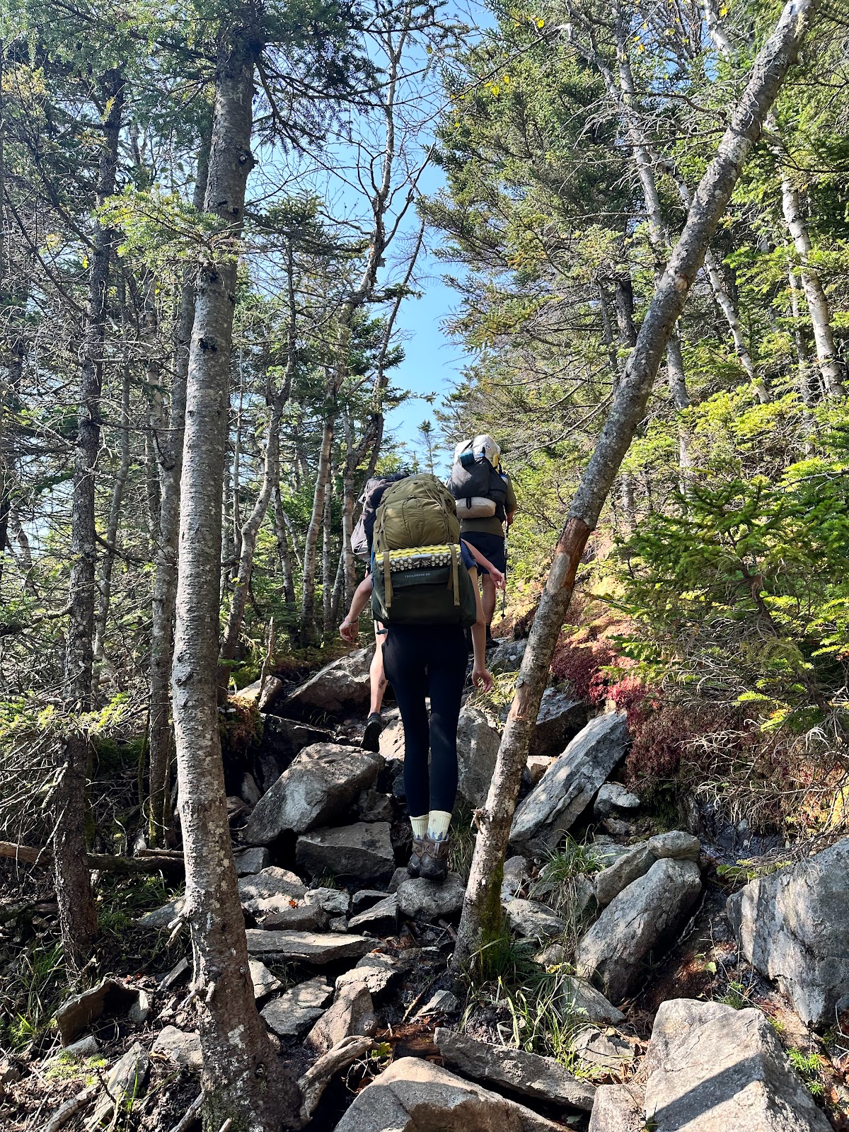
 We drove up to NH the night before, using the esteemed and affordable Notch Hostel as a launching pad for our trip. Before we knew it, we were at Lincoln Woods and on the trail. It was late September and fairly chilly in the morning, but the forecast promised to be sunny and partly cloudy for the next 3 days, pretty much as good as you can get in a place known for it's terrible weather. We were hoping to see some sweet foliage, but we were a bit too early. The Pemi Loop can be done either clockwise or counterclockwise, although most people do it CCW, which is how we did it. From Lincoln Woods Trailhead, we got our stuff together, talked to a ranger with a nice old dog, and started off. The first section of trail is a nice, easy warm-up along the mighty Pemigewasset River, covering a grueling 450 feet of elevation over 4.5 miles.
 At this point, the trail turns left (north) to follow Black Brook and playtime is officially over. The ascent of Bondcliff is about 4 miles and 2400 feet and was pretty grueling at times, but I didn't really notice due to that sweet Pemi high. We caught our first view out of the trees before crossing Black Brook and a little while later caught our first great view just under the summit of Bondcliff, at a location I believe is typically referred to as Hillary's Step. Emerging above the treeline at Bondcliff was incredible. The vegetation changes very abruptly as you pass the tree line and the wind picks up, and you can feel the mountainous aura emanating all around. And the views are amazing as well. It's pretty much a 360 view and we could pretty much see the entire Pemi Loop. To the north, Guyot, West Bond, and Twin loomed. And to the east, beyond the minor bump in the center of the Pemigewasset Wilderness known as Owl's Head, the legendary Fraconia Ridge lay shimmering in the distance. I really enjoy seeing where I am going/where I have been on a route. A promise of continuity in our trip. The cliff at Bondcliff is massive, so take caution when taking photos, etc. We were lucky that there was very little wind when we were up there. We took our iconic Bondcliff photos, vibrated with that sweet Pemi high for a bit, and continued on.


Emerging out of the treeline at Hillary's Step (left) and iconic photo-op at Bondcliff Summit (right)
View of Fraconia Ridge (with Owl's Head in the foreground) from Bondcliff
The trail continues along Bondcliff for another mile or so and then begins a steep, rocky 0.5 mile and 600 foot ascent up to Mt. Bond. During our ascent we could hear what we assumed are fighter pilots flying around the Whites, for who knows what reason. Looking back at Bondcliff is always a good time along this stretch. From here, it's another 0.7 miles to the turn-off to Guyot Campsite where we stayed the night. We had to pay $15 per person to camp and I believe it was cash only. The campsite is on a thickly wooden slope and was pretty much popping when we rolled thru. The campsites themselves are platforms and it's a bit tough to squeeze 3 tents in there, but we made it work. While we were setting up camp, a bull moose suddenly appeared a bit down slope and just kind of...ran through the campsite. It was pretty crazy and got everyone excited. A more usual feature of this campsite are the gray jays, which have learned that this is a pretty good place to get food. After we set up camp, we grabbed our food stuff and made our way out to cook dinner on West Bond. This ended up being a brilliant idea. The sunset from up here was unreal. It feel like you're in the middle of the Pemi Wilderness and the setting light on Bondcliff was especially beautiful. We hiked back in semi-darkness and before too long fell asleep.


Our setup at Guyot (left) and breakfast at Guyot (right)
Sunset dinner on West Bond (left) and sun setting over Fraconia Ridge from West Bond (right)
Day 2:
Start: Guyot Campsite
End: Liberty Springs Campsite
Stats: ~14 miles + 5200 feet of elevation (including Galehead)
 Today was the long haul day. We had to loop around the bulk of the ridge circuit and were looking at 12+ miles to get ourselves over to Liberty Springs Campsite on the other side of Fraconia Ridge. We woke up in time to catch a sharp red sunrise from the beautiful little bunk hut at the Guyot site, along with most of the other inhabitants of the campsite. There was a nice feeling of camaraderie and everyone was having a good time. After making coffee and breakfast, we packed up camp and headed out of the campsite, our sense alert for marauding moose. After getting back up to the ridge, the trail continues north for a simple 200 foot, 0.6 mile ascent to Mount Guyot, which has some rocky expanses and neat trails through small shrub, in addition to solid views. A nice, easy way to warm up for the day. From Guyot, the trail overlaps with the Appalachian Trail and there is the opportunity to go NOBO on it for a 1.1 mile detour to bag Zealand, but we didn't want to this time. We had a big enough day already. After a brief descent to the saddle from Guyot, the trail gradually climbs up about 500 feet to South Twin over about 1.5 miles in some variably forested terrain. So far so good. The views from South Twin are also incredibly good, with a clear shot over to the Presidential Range, in addition to the usual look at Fraconia Ridge and Bondcliff. You can take another 1.1 mile detour to snag North Twin from here, but we again passed. From South Twin, the trail drops over 1000 feet in an incredibly steep, wet, and rocky 0.7 mile section to the saddle before Galehead Mountain. There is an AMC hut at Galehead with basic amenities and the opportunity to spend some largish amount of money to sleep in moderate luxury. We dropped our bags here, poked around, drank some water, and then jogged an easy 0.5 miles to bag Galehead, which could be considered an optional peak.
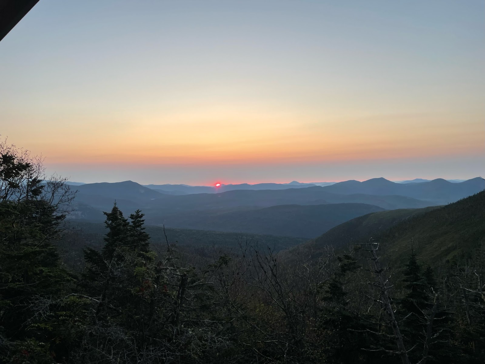

Sunrise from Guyot campground (left) and gradual descend down Guyot (right)
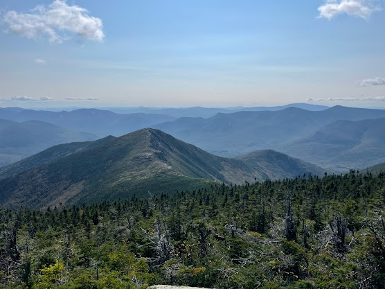
Looking towards the rest of our day: Garfield and Fraconia Ridge from South Twin
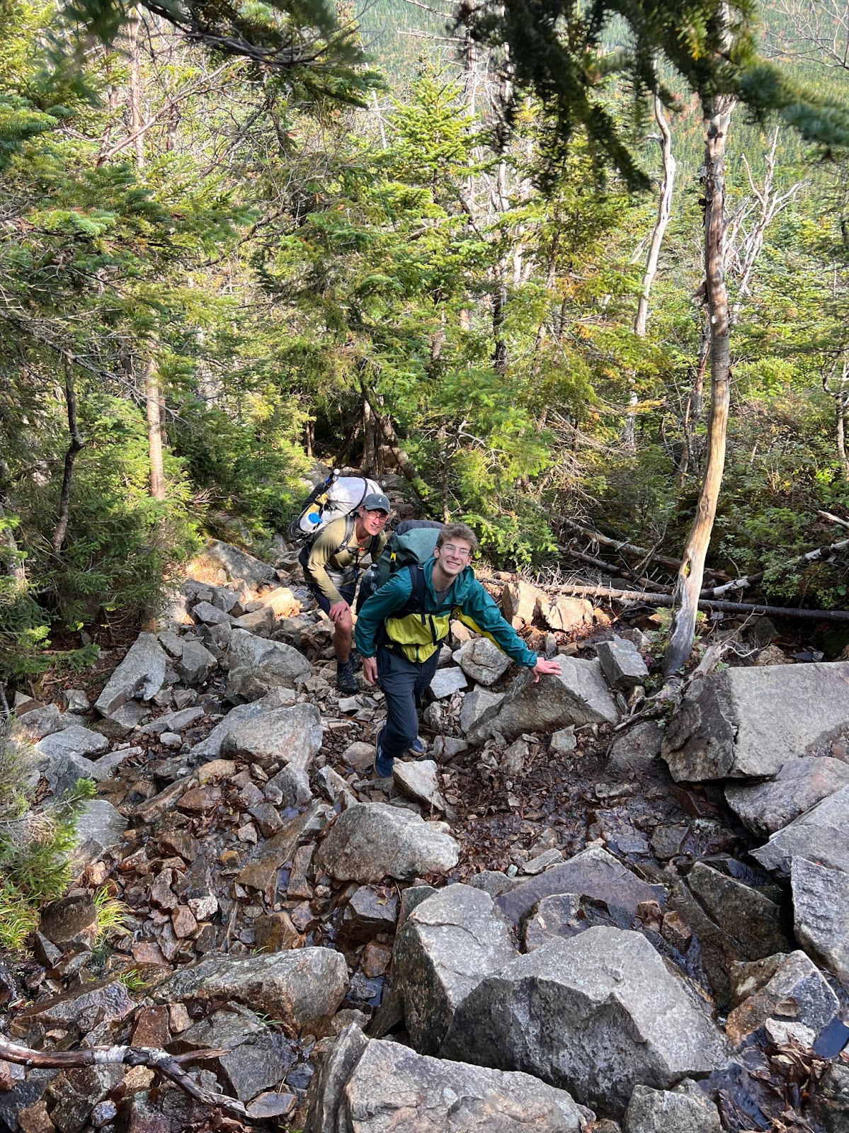
The next 2 miles or so weave through deeper forest along the East and West Garfield Ridges. This section wasn't particularly difficult, but it felt monotonous and we were anxious to start climbing up Fraconia. Things got pretty interesting pretty quickly for the ascent of Garfield, though. This section of trail was basically a 1000 foot climb up a waterfall. Very fun. We anticipated finding water after Garfield so we neglected filling up while we were going up the waterfall and the spot we hoped to find water at was not actually viable, so we had to ration for the rest of the day. Turns out there is apparently a piped source by the spur-trail to the Garfield Shelter, just before the summit of Garfield. Oh well. The summit of Garfield is a really cool one, being situated pretty much smack dab in the middle of the ridges circling the Pemigewasset Wilderness and offering a direct view down the middle of said Wilderness.

Ascent up Garfield waterfall (left) and view of Fraconia Ridge from Garfield (right)
From Garfield, the trail descends another 1000 feet before ascending up Garfield Ridge (again?) and, finally, up Lafayette and onto Fraconia Ridge proper. We had a little under 2000 feet to climb to get up to Lafayette and we were already 7.4 miles in, thirsty, somewhat tired, and with miles to go--but getting above the treeline on Lafayette gave us a second wind. The exposed ridge was beautiful and we stomped through cobbles and increasing wind as we worked our way towards the peak of Lafayette, the highest point of our trek at 5249 feet. The high ridge was shrouded in periodic fog, possibly smoke from Canadian wildfires (shoutout to summer 2023 in the NE) and the sun was beginning to set, which was cool to see from so high up. At this point, the trail is marked by rock cairns. We could catch the occasional glimpse of Bondcliff and the ridges we had traveled over the last day and a half.


We continued through the misty ridgeline, traversing Mount Truman, Lincoln, and Little Haystack for another 2 miles or so. Much of the ridgeline trail is enclosed by lines of rocks on both sides, encouraging people to stay on the trail and not genocide the local alpine flora/microbiota. The terrain is rocky and exposed but isn't too technically demanding. After Little Haystack we descended back under the tree line and I wish we hadn't. The sky was pretty much overcast as we did this traverse, but about 15 minutes after getting into the trees, we could tell that the clouds had broken and what seemed to be a bomb-ass nutty super sunset was happening and I would have pushed my non-existent grandma into a pool to have been on the ridgeline for it. Oh well. The sun set and soon we found ourselves in some pretty serious darkness. But we found our way to the Liberty Springs Junction and down to Liberty Springs Campsite, where several other people were working their way into bed. We found a campsite, filtered a nut-ton of water, and made a quick dinner before hopping in to bed.

Shadows on Lafayette (left) and view of foggy/smoky skies on Fraconia Ridge (right)
Looking south after Lafayette (left) and looking back at Mount Lincoln before Little Haystack (right)
Evidence of missed sunset opportunity (left) and last look before the treeline after Lil Haystack (right)
Day 3:
Start: Liberty Springs Campsite
End: Lincoln Woods Trailhead
Stats: ~7.5 miles + 3700 feet of elevation loss
We woke up well rested and took our time making breakfast, drinking coffee, and chatting with the other campers at the site. Unfortunately, the campsite is on a steep incline so the day started out with a 400 foot climb back up to the Fraconia Ridge Trail. From there, it's another 200 feet up to the top of Mount Liberty. A fairly rude start for the day, but Mount Liberty boasts a nice, but small rocky outcropping and great views, including some sweet angles back to Bondcliff. It was sunny, but somewhat smoky and the clouds were long and wispy, which made everything feel somewhat more ethereal.
Looking ahead to Flume and back at Bondcliff from Mount Liberty (left) and big outcrop (right)
From Liberty, it's another 1.3 miles under the treeline to Mount Flume which involves a 600 foot descent down to the col and then another 400 feet up. Smoke continued to fill the sky and we got our final look back at Fraconia Ridge.
Looking back at Fraconia Ridge from Mount Flume
After Flume, the trail descends gradually for another mile or so before becoming significantly steeper. This section was quite muddy for us and involved a lot of log hopping. There are also several wooden ladders to climb down during this section. After about 3 miles the trail finally rejoined the Lincoln Woods Trail, which we were happy to finally see. We were beat and fantasizing about a good feed. A simple but seemingly long 1.3 miles along the Lincoln Woods Trail brought us back to the trailhead and our car. We stopped before crossing the Pemigewasset River to take dip in the frigid mountain water and celebrate having had the privilege, competence, and luck to successfully complete one the most iconic traverses in the NE.
Final view descending Flume via the Osseo trail (left) and bottoming out on the Osseo (right)
This certainly was a difficult trip, but I wouldn't consider it the most difficult I've ever done. I think from a trail technicality and exposure perspective, both the
Superstition Ridgeline,
Loch Coruisk's Bad Step, and Katahdin's Knife Edge (duh) were more ferocious. Granted, we got lucky with the weather and if that turned out differently I could be writing from a very different perspective, or not writing at all. Regardless, it was a beautiful traverse and one that I'm very glad to have completed. This trip cemented Jon and I as backpacking buddies, as we had actually not met prior to this trip. We've gone on several other trips since this. It also further cemented Lorrie as a backpacking homie who I hope to include in more trips in the future. And Ivy is a beautiful, incredible genius who is good at everything she does and who has become an excellent backpacker basically without trying. Ok, that's it. Get out and do the Pemi!


No comments:
Post a Comment