Backpack an outstanding 32 miles in the Superstition Wilderness, a collapsed volcanic caldera, a fossilized volcano whose eruptive materials were found as far as Arkansas. Winter rains bring the Superstitions to life, temporarily covering the rugged desert landscape with a green veneer and transforming its canyons into lush oases. Weaving through saguaros and traversing a 10-mile exposed ridgeline, this backpacking route is surely one to remember. And it's only short 45 minutes from the Phoenix-Metro area.
At a Glance
Trail Type: Point-to-point
Time: 3 days
Mileage: 32 miles
Elevation Gain: 6500 feet
Start: First Water Trailhead, Apache Junction, AZ
End: Siphon Draw Trailhead, Apache Junction, AZ
CalTopo track: https://caltopo.com/m/208QS
I hold the Superstition Mountains with a reverence perhaps bordering on idolatry. The "Supes", as they are often locally called, are a large wilderness area due east of the Phoenix Metro area, flanked on their western edge by the iconic Superstition Mountain and one of the most popular and challenging day hikes in Arizona: Flatiron. As a graduate student at Arizona State University, the Superstitions were often looming in the distance whenever I drove on the local highways and could be seen from many vantage points within the metro area itself, making their siren call both taunting and chronic. The Supes are also a fascinating place geologically speaking. The eastern Supes--the area this route traverses--is actually a large fossilized volcanic field which was active between 20 and 30 million years ago. After its most recent eruption, the volcano collapsed into its partially emptied magma chambers, producing a caldera. This caldera was subsequently uplifted by the rising heat of the remaining subsurface magma, producing what is called a resurgent dome. This actively eroding resurgent dome is the structural backbone underlying the modern topography of the Superstition Mountains. This particular geological history also means that the area is an ok place to go rockhounding! There are several interesting silica deposits such as chalcedony which were formed by water circulating through fractures in the collapsed, still hot volcano. And rumors of more interesting things, like gold...
I went camping there a few times with some other students and it was always memorable, but it wasn't until my last few months in Arizona before graduating that I really began to get "into" the Supes and I made an effort to traverse every trail in the more accessible eastern Supes and took a pretty decent chunk out of it. But since graduating and moving back to NY, I haven't had my dam Supes fix...so I took things into my own hands.
Trip Report
Trip Dates: 9/21/23 - 9/23/23
Day 1: Lincoln Woods TH to Guyot Campsite (12.7 miles and 4100 elevation gain)
Day 2: Guyot Campsite to Liberty Springs Campsite (14 miles and 5200 elevation gain)
Day 3: Liberty Springs Campsite back to Lincoln Woods TH (7.5 miles and 3600 elevation loss)
This past February, we set out for a 3 day, 2 night backpacking trip in the Superstition Wilderness featuring lush canyons, unique geology, giant saguaros, and a BLANK ridgeline traverse. The Superstitions are no secret unto themselves, at least not to people in Arizona, but for most the adventure doesn't extend beyond Flatiron [link] and Fremont Saddle [link]. While these are incredible features worth visiting, the Supes have much more to offer. I went to graduate school for geological sciences at Arizona State University and spent a fair bit of time exploring the Superstitions and developed a decent sense for what the region had to offer (at least the Eastern Wilderness). When planning this trip, I wanted to create a route that condensed the best of the Supes into just 3 days. Here's a walk through what that ended up looking like. CalTopo link: https://caltopo.com/m/208QS
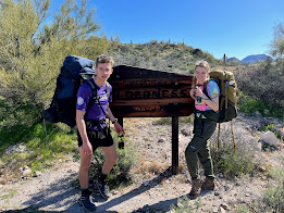
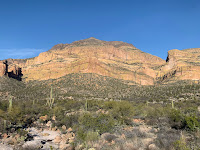
This is a cartoonish overview but it gets the point across. We started our trip at First Water Trailhead, which is the origin of some of the more popular hikes in the area and features the commonly used Dutchman's Trail (104). From First Water, we started on the Dutchman's Trail and quickly branched off to Second Water Trail (236), weaving through a small canyon and up to a choice area of flat land called the Garden Valley. The trail continues north here and the aptly named Black Mesa can be seen to the right (southeast).
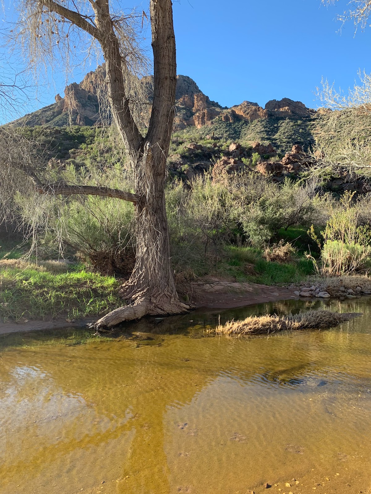
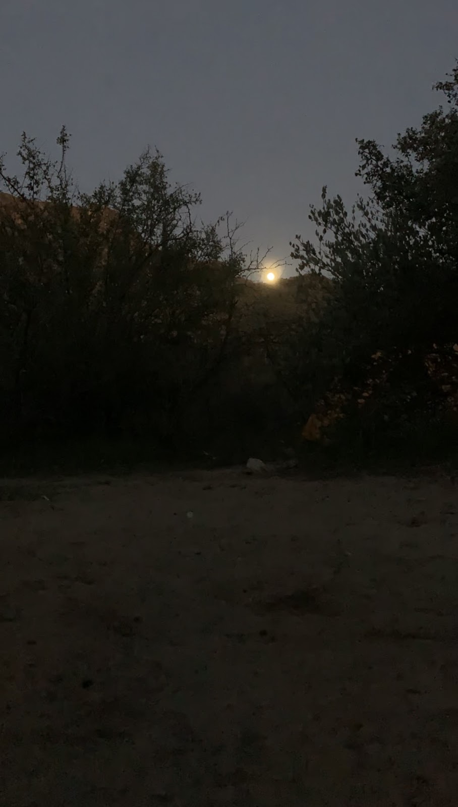 After 3.1 miles the Cavalry Trail meets back up with the Dutchman's Trail and continues southeast into another wet riparian corridor, this time under the jurisdiction of La Barge Canyon. La Barge Creek is to the left of the trail and there are a handful of viable campsites along this grassy section of trail. We picked one we liked, set up camp, filled up on water from the well-flowing creek, and gathered some firewood and rocks. This is where grabbed this nice chunk of chalcedony, which is even cooler on the inside. As the sun fell, shadows filled the canyon as the sun fell behind Bluff Spring Mountain to the south, but the canyon once more became illuminated as the full moon rose over Black Mountain to the north.
 At this point, we were on Bluff Springs Trail (235), working our way up to higher elevations and an intersection with the Terrapin Trail (234). We found it, appreciated the view into Barks Canyon, and worked our way up to Bluff Saddle. From here, we had to cut off of the official trail and followed a sufficiently worn and AllTrails marked route crossing under the shadow of Weaver's Needle. This section of trail was longer than it seemed but eventually spat us out on the Peralta Trail (102) within the verdant Boulder Canyon. We filled up our water again. The sun was gone beyond the Superstition Ridgeline to our west as we marched up the canyon to Fremont Saddle, with its tremendous views of Weaver's Needle. This is an incredibly busy spot of the Superstitions, as it offers incredible views and is only 2 miles from a moderately accessible trailhead, but we were alone up here.
 On a whim, we decided to check out the rock peninsula which juts our directly in front of Weaver's Needle. Given its linearity with Weaver's Needle, this section of rock was presumably once contiguous with it, but for whatever reason was differentially eroded over time, resulting in this "peninsula." This was a spot that I had fantasized about camping at while I was living in Arizona and when we got over there we saw there was enough space for us to camp, sweet! We set up our tents, made a fire, and ate, taking periodic trips to the furthest most rocks to take pictures of Weaver and the surrounding canyon walls.

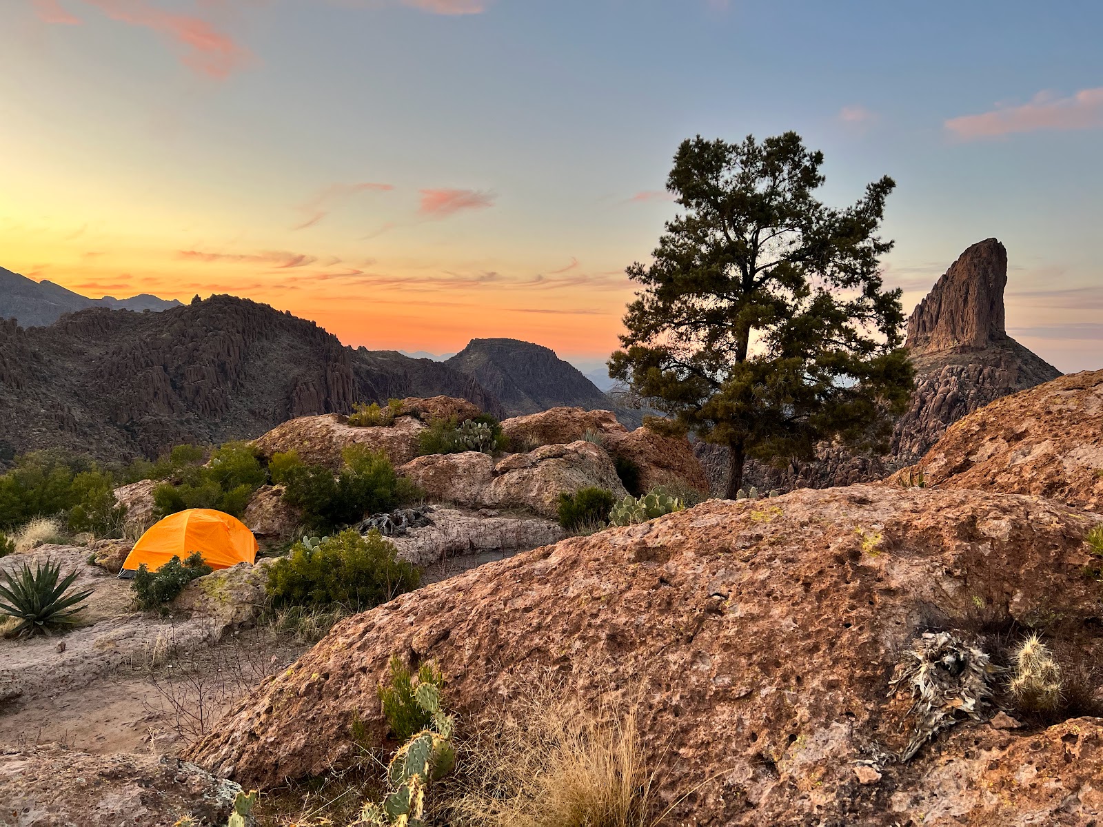
This is really a special spot and it was amazing to be watch Weaver change with the light through sunset, moonrise, and sunrise. Night 2 complete. Enter the dawn of the final day.


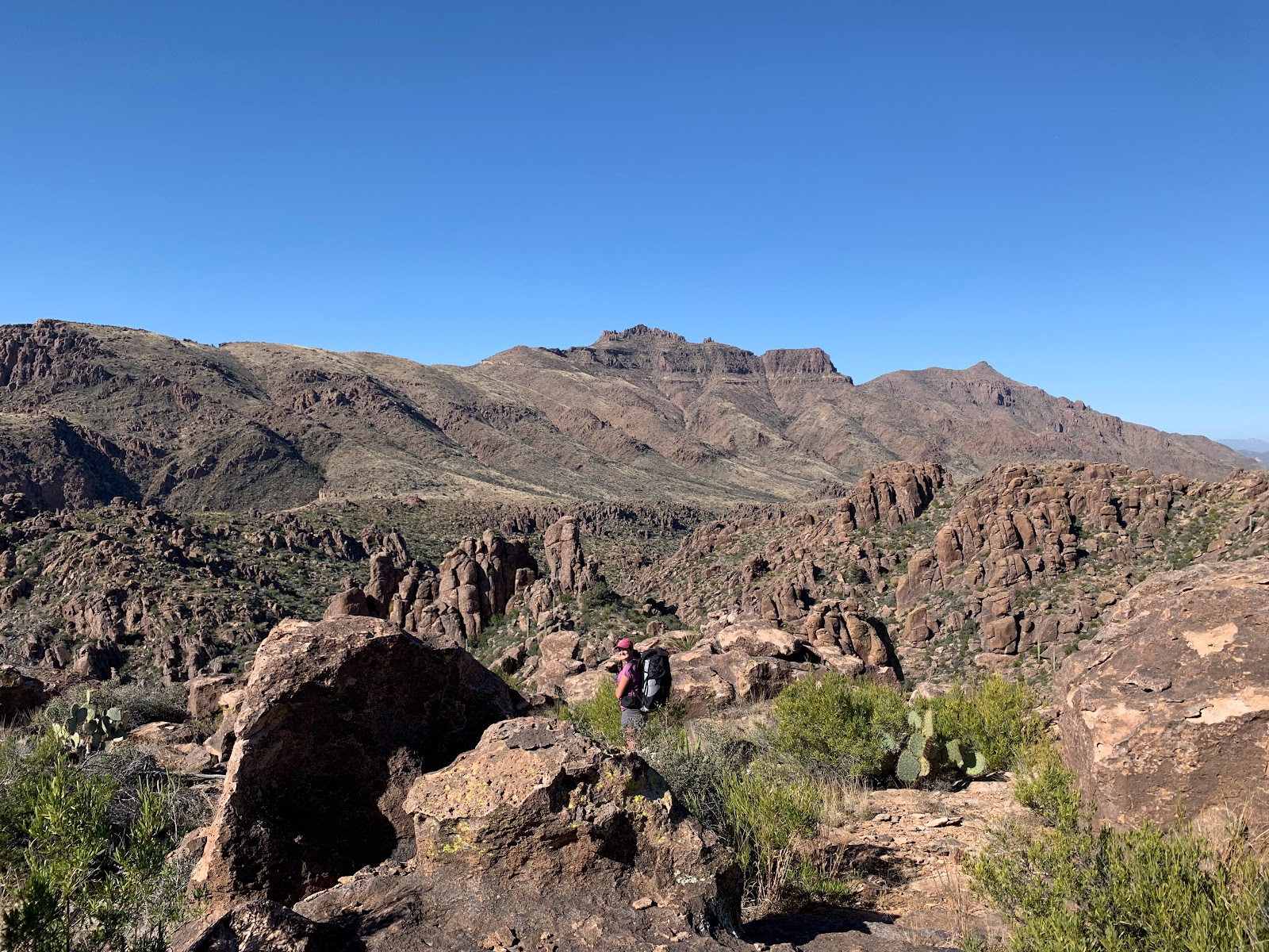
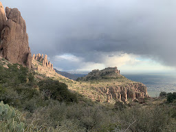
 On several occasions we had realized we had misfired slightly and had gotten on a lesser trail that an unknown number of unfortunate souls had paved out for us previously. Our choices were to either turn back a few hundred meters and rejoin the "main" trail or continue on our lesser trail, hoping for a quick reunion with the main trail. We typically charged ahead, although this put us in some precarious positions that it might have been nice to avoid. While difficult and somewhat treacherous, this trail is absolutely stunning. The Superstition Ridgeline is the southwestern most feature of the Wilderness and offers sweeping views of Gold Canyon and the Valley to the south and of the Superstitions to the north, including most of the notable geographic features like Four Peaks far to the north and most of the landmarks we had passed over the last 2 days including Weaver's Needle, Bluff Springs Mountain, Black Mesa, and Malapais Mountain. Along the way we bagged the highest point in the Eastern Superstitions at 5057 feet: the ingeniously named Peak 5057. Around this point, some storm clouds could be seen rolling in over Four Peaks from the northwest, which was pretty disturbing. Getting caught in a storm on a ridge as high up and exposed as this would not be pleasant, the least reason being that we hadn't thought to bring raincoats. The most reason would be that we'd be running the chance of getting struck by lightning, washed out into the prickly canyons thousands of feet below, or carried off by any errant wind that happened to pass us by in the wrong mood. Luckily, the brunt of the storm missed us, instead seeming to fill in the area in the wilderness to our north. We did, however, get hailed on for a bit, which in tandem with the sun filtering through the clouds struck a pleasant balance between fear and wonder.
 Still riding the high that we hadn't been struck by lightning, we reached the end of the ridgeline and passed by Flatiron, but by this time we were on our last bits of water and quickly running out of daylight. We started our descent of Siphon Draw around 6pm, and the sun set around 6:15. Yikes. The upside was we were granted an incredible fiery sunset from within the canyon. To this date, Siphon Draw might be the steepest trail I have been on. It covers about 3k feet of elevation over 3 miles, but the majority of that is done in the last 1-1.5 miles. It's understandably one of the most popular hikes in the valley, but this late in the day we didn't see another soul. Climbing down Siphon Draw is arguably worse than climbing up it, as gravity is conspiring to topple you down the canyon, and this was made worse by our outrageously heavy packs. At 2 points we had to take our packs off and lower them down before making the climb ourselves. Having our tent strapped outside of the pack also made things far more treacherous, as it made it way more difficult to fit into the small slots we had to climb down and way more liable to accidentally bounce your way into a 10+ foot drop. The light was almost completely gone as we reached the bowl/basin area (if you've been here you know what I'm talking about) which fortunately also signaled a decrease in slope for the remainder of the trail. By the time we got to the parking lots at Lost Dutchman it was probably about 7:15-30 and completely pitch-dark and we were warned that the park closes its gates at 8pm, so if we hadn't been back in time we would be locked in. It seems like we got on by the skin of our teeth this day, but I wouldn't trade it for anything. After spending days admiring the ridgeline from afar, it's incredible to not only finally ascend and traverse it but also to look back on all the terrain you had previously covered. This route comprehensively pulls together the expansiveness, diversity, and wild beauty of the Eastern Superstitions in a way that is hard to match in a 3 day trek.









No comments:
Post a Comment