Backpacking in the Catskill Mountains: Long Path Sections 23-25
On the eastern edge of the Catskill Mountains lies the Catskill Escarpment, a 10 mile, 3,000+ foot cliff looming over the low-lying Hudson River Valley. If you've ever driven up the New York State Thruway, you've seen the Escarpment jutting starkly to the west. Long Path sections 23-25 traverses significant parts of the Escarpment, weaving through the remains of a historic hotel, circumventing a glacially carved lake, summiting balsam capped high peaks, and passing an impressive number of glacially plucked ledges, often offering expansive views of the Hudson Valley.


At a Glance
Trail Type: Point-to-point
Time: 2 to 3 days
Mileage: 22 miles
Elevation Gain: 6400 feet
Catskill High Peaks: Blackhead and Windham High Peak
Start: Harding Road Trailhead, Palenville, NY (https://goo.gl/maps/gvtJvC9SYDsmzKsA8)
End: Escarpment Trailhead, Windham, NY (https://maps.app.goo.gl/ukrN8pANs9ZYiSJt5)
Trip Dates: 9/3/23-9/4/23
Water Availability: solid, water flowing in expected places
Trail Overview
These final sections of the Long Path (LP) within the Catskills pick up where the previous finished: the Harding Trailhead at the base of the deeply carved Kaaterskill Clove on 23A in Palenville. These LP sections largely overlap with the better-known Escarpment Trail, with the only real difference being that the Long Path starts within Kaaterskill Clove, whereas the Escarpment Trail typically starts 2000 feet above the Clove's base, up at North-South Lake. Strangely and somewhat irritatingly for someone who enjoys the sweet satisfaction of geographically coherent backpacking routes, the Escarpment Trail doesn't actually run the full length of the Catskills Escarpment. You'd have to start much further south, near Overlook Mountain in Woodstock, for the real deal. I'd like to do the full traverse some day.

Trip Report
Day 1:


Me and Ivy at Sunset Rock (left) and view south from North Point (right)


Lunch spot at North Lake (left) and a great change in depositional environment (right)
From North Point, we pressed further along the Escarpment another 3.5 miles before dropping steeply down to Dutcher Notch at 2500 feet. This is a pleasant stretch of trail which doesn't ask too much of you and also offers 2 good viewpoints at Stoppel Point and Milt's Lookout. Stoppel falls just short of being able to claim the title of a Catskill High Peak (>= 3500 feet) but that doesn't stop it from having a nice view. Just beneath Stoppel you'll also find the remains of a plane crash. I'm not sure what the history is but it probably wasn't a fun time. Once we hit the trail junction at Dutcher Notch we shot down east to collect water at a pretty reliable spring about 0.5 miles down the trail. A bit of a haul for water with more vert than we would have liked, but so it goes. And it was worth it because we ended up running into a woman, Destiny, who was leading/guiding a camping group down at Colgate Lake. Ivy, being the amazing girlfriend that she is, and knowing that I was interested in doing something like this but was too shy to directly ask about it, asked Destiny if I could get her contact info and talk to her about getting involved. Writing about this trip some 6 months later, I can proudly say that I am an official member of the Destination Backcountry Adventure (DBA) team and participated on my first guided camping trip as an apprentice back in early February. Thanks again, stink.


After filling up our water and saying goodbye to Destiny, we hopped back up to the Dutcher Notch junction in the rays of the lowering sun, becoming more aware of our limited time to find a campsite. If you're doing this in 3 days, I'd recommend pushing on to Batavia Kill Lean-to. Doing it in just 2 days here, we had 3 options:
1. climb up 1500 feet to Blackhead and drop another 1000 feet down to Batavia Kill Lean-to, about a 3 mile trip (not Batavia Kill Shelter--which sounds like a place you never want to go if you are a dog)
2. find a place to primitive camp (below 3500 feet) on the ridge before Blackhead
3. Camp at Colgate Lake where Destiny and the DBA crew were
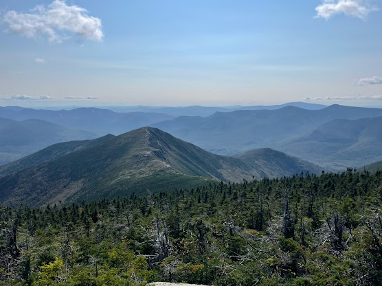
Having already gone about 10.5 miles and done 3400 feet elevation, we were not looking forward to the idea of going up and over Blackhead and at the time I wasn't even aware of campsites at Colgate (nor would I have wanted to crash the DBA party), so we elected for option 2: shoot up to Arizona Mountain and the ridgeline before Blackhead. I remembered this area from a previous trip of the Escarpment Trail back in 2021 and recalled areas that seemed suitable for primitive camping. Since we only had a single 2p tent to negotiate, this ended up being even more plausible. On the climb up Arizona we caught another nice view back at the Escarpment Trail (with the Devil's Path off in the distance) and were then caught off guard by how nice and grassy the area around Arizona Mountain is, especially in the fading sunlight. We found a spot to set up camp in the shoulder beneath Arizona and Blackhead, made some dinner, sniffed each other, and decided we'd wake up early to catch a sunrise at Blackhead, where I knew there should be good views.


Day 2:
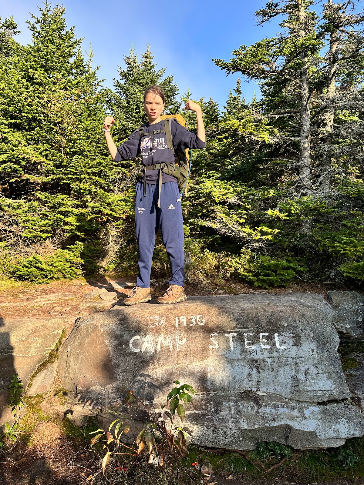
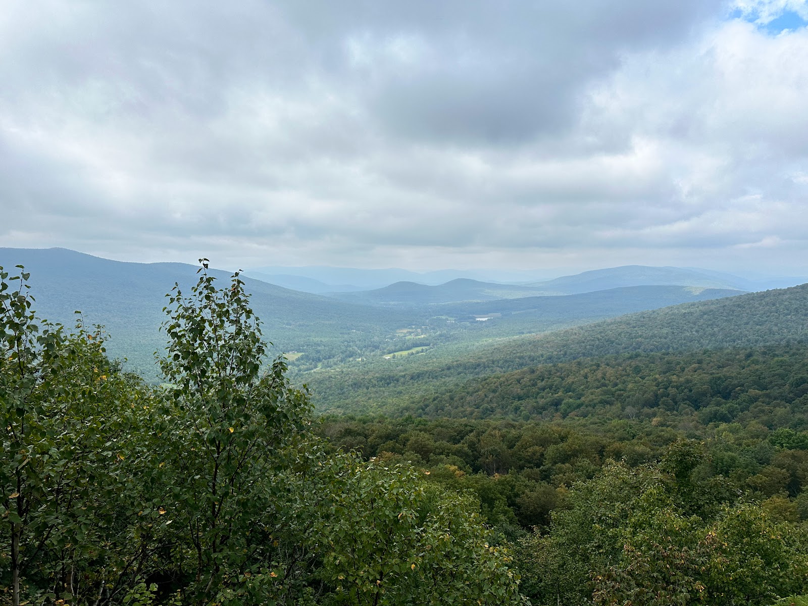
On day 2, Ivy and I woke up early to pack up camp and summit Blackhead to watch the sunrise from Camp Steele. The view from up here is great--the mid Hudson Valley, Albany, the Taconics...we unpacked, set up breakfast, and drank coffee, soaking it all in. It was all incredibly pleasant. It was chilly to start and there was something between a breeze and a wind pushing wispy clouds over our heads, but both the clouds and our chill quickly dissipated in the growing sunlight. Once we had had our fill, we descended Blackhead to the Batavia Kill junction, which is a particularly steep and fairly technical section. I hopped down to Batavia Kill proper to refill some water and we set back off north along the LP, through about 2 miles of simple but beautiful trail which brought us to Acra Point. There's a nice lookout to the northeast where you can see Albany quite well. There is also a short spur trail (Yellow Mark) near Acra Point which leads to a western lookout showcasing a pretty incredible view of the Blackhead Range.


Wrapped up for sunrise (left) and Ivy and Poo Poo Duck (right)

Jefferson Steel Flex (left) and view of the Blackhead Range from Acra Point (right)


Stream-time merriment


Walking the plank on descent of Windham (left) and pancake mushroom (right).


No comments:
Post a Comment