Overnight backpacking to a small piece of land nestled between an inland lake and the sea, sitting within the shadow of the iconic Black Cuillins: undoubtedly one of the most beautiful spots on the Isle Of Skye. Oh, and doing it via the Bad Step--likely the most challenging section of trail you've ever done.
At a Glance
Trail Type: Loop
Time: 2 days
Mileage: 15 miles
Elevation Gain: 2800 feet
Start/End: Camasunary Car Park, Kilmarie, Isle of Skye, Scotland
CalTopo route track: https://caltopo.com/m/5001E
Not many places can boast the beauty and feeling of remoteness that Loch Coruisk offers. Uniquely situated at the foot of the rugged and beautiful Black Cuillins, Loch Coruisk is a freshwater inland loch (lake), about 2 miles long and 400 meters wide, from which the shortest river in Scotland flows a brief 400 feet into the nearby saltwater "sea loch", or bay, Loch Scavaig. It's not often that you find a large freshwater lake this close to saltwater, let alone one nestled under the shadow of the UK's most intense mountain range. The Black Cuillins are the remnants of a 60 million year old volcano which extruded huge amounts of basalt and gabbro, giving the range a dark color and associated "black" title, in addition to its rough, jagged texture, which fortunately makes it very suitably grippy for hiking and climbing. So what do you when presented with a place often referred to as "the wildest scene in the UK"? You go there. And not only that, you go the hard way.
4 Ways to Loch Coruisk
There are 3 ways to get there, ranging from easy, to somewhat challenging, to potentially life-threatening.
1. The first is a boat from the nearby town of Elgol. If your main focus is seeing marine wildlife, this might be your best bet. More info here: https://mistyisleboattrips.co.uk/

3. The third way to get there is to skirt around the base of Skurr na Stri, via a traverse known as the Bad Step. This is actually the shortest route, but it by far the most technical.
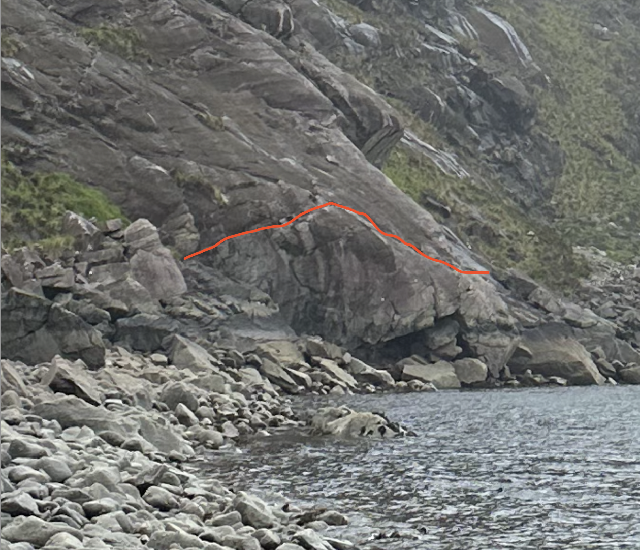
A few days prior, we had departed from Sligachan for a day hike up to the beautiful Sgurr na Stri (Peak of Strife), situated above Loch Coruisk and Loch Scavaig, which offers some of the best views in the UK. It was while we were up on Sgurr na Stri that we saw someone camping waaaay down on a little piece of land situated between the enchanting turquoise waters of Loch Scavaig and the deep blue of Loch Coruisk. We also saw a rock with little silver dots we suspected were seals and even saw a shadow moving in the water, which we think might have been a minke whale! We knew we had to go there. The hike from Sligachan to Coruisk is about 7 miles and not overwhelmingly difficult, but as we had just hiked 5.5 out of those 7 miles to get to Sgurr na Stri, we started looking for new, alternative routes to get there. Lo and behold, it looked like the shortest route to Loch Coruisk actually involved leaving from Camasunary carpark by Kilmarie, hiking over to Camasunary Beach, and circumnavigating the coastal edge of Sgurr na Stri which spits you out right by Loch Coruisk. This clocks in at a relatively low 5 miles...but the catch is that it involves crossing the "Bad Step" a semi-notorious stretch of trail involving traversing a ~20-25 foot crack in the rock, with a 15 foot drop into the rocky water of Loch Scavaig below. Since I'm always looking to go with the more insane option when possible, I was interested in the Bad Step but wasn't sure if we'd be able to pull it off with packs, especially since Ivy gets trail-anxious more easily than I do.
Track to Loch Coruisk via the Bad Step, from Camasunary carpark.
4. There is actually a 4th way to Loch Coruisk, which is to start at Camasunary carpark and to go up and around Sgurr na Stri from the north, passing Loch na Creitheach along the way. This route involves the most elevation change and is longest at about 9 miles.
The "Long Way" to Loch Coruisk from Camasunary carpark
We had resigned ourselves to taking the long way, as it offers both new trails and a more assured way of getting there. But then the divine intervened: a rugged Scotsman. After eating breakfast the morning before we drove to Camasunary, we wandered into an outdoors store and asked the rugged, middle-aged owner his thoughts on the Bad Step and he shrugged it off as being nothing, saying it depends on your fitness level. This was somehow enough to get Ivy on board with the concept and I was feeling spontaneous and wasn't about to spoil it by suggesting that this dude has probably climbed every mountain on Skye at least 20 times and that it still may be challenging for us, even if not for him. And so we were off.
Trip Report: Loch Coruisk via the Bad Step
Day 1: Loch Coruisk via the Bad Step
Trip Dates: 5/23/23 - 5/24/23
Stats: 5.5 miles and ~800 foot elevation change
From the carpark it's a straightforward ~2 miles up and over a small saddle which provides nice views of Sgurr na Stri looking over the bleak but beautiful Camasunary Bay, which would be a cool place to stay in its own right. There is an old house down there and both a functional and non-functional shelter in case you needed some place to stay.
View from the saddle before descending down to Camasunary Bay. Sgurr na Stri sits shrouded in mist in front and red highlights our route, which wraps around the ocean-side of Sgurr na Stri, where the Bad Step is.
After crossing the beach of Camasunary Bay, you have to cross the Amhainn Camas Fhionnairidh, a decent-sized river which luckily was not flowing very heavily, which will take you onto the jutting peninsula aka the base of Sgurr na Stri. At this point you begin navigating what is probably one of the least used parts of the Isle of Skye, at least by non-locals. The trail is wet and hard to follow at times, and the wind coming off the sea can be a factor. By the time we reached the tip of the peninsula, some anxiety started to set in and we lapsed into silent focus. The last mile before the Bad Step is somewhat difficult to navigate itself and involves crossing several sheer rock faces, which are slippery when wet and require hand use at times. And unfortunately for us, a foggy/mist had been rolling in during this last mile and was threatening to transform into full blown rain.
Approaching the Bad Step, which is highlighted in red
The only emotion to describe the feeling once we had safety made it across is elation. I still get giddy thinking about it while editing this post about 10 months later. After the tense and foreboding initial hike in and the near-boiling stress of the time we spent deliberating whether to go for it, it was an incredible relief to have safely made it across the Bed Step. And we made the right decision, as the storm continued to pick up and within minutes there was full fledged rain. Let's GO! The rest of the hike to the beach was tricky too, due to the wet and incredibly slippery rocks, but it was still beautiful.
Approximation of the Bad Step Route (left) and elation and triumph afterwards (right)
After reaching the beach, you have to climb up a bit and cross the River Scavaig to reach the little jutting piece of land where we intended to camp. It was actually a longer and more difficult walk than it seemed from the top of Sgurr na Stri (and even while looking at it while approaching the Bad Step). But we finally got there, wet and happy, and saw 2 tents already set up and some kayaks resting nearby. To our surprise, we also saw a nice looking white and blue building, which we have since learned is the Coruisk Memorial Hut. The hut is privately owned and used by some local Mountaineering Club dedicated to some dudes who died up in the Cuillins in the 80s. We noticed a light on in the hut, though, and decided to knock on the door. 2 older guys let us in to check it out and told us that they had come down from nearby Bla Bheinn and were working into the Cuillins proper the next day. They had rope and full climbing equipment--no joke. Compared to something like that, the Bad Step is probably a joke. Huge respect to those guys. We also said hi to our tent-bound neighbors and were again met with 2 middle-aged men who told us that they had kayaked in from Elgol. This was nice. The only other people here seemed to be rugged, borderline insane Scottish men. I felt like we were in good company. So we picked a likely spot, set up our tent, and crawled inside to change our wet clothes and have something to eat while we waited for the rain to calm down.
Views of our campsite.
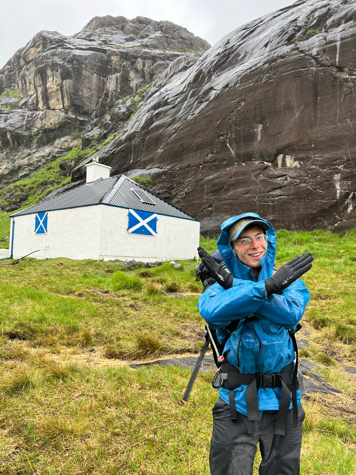
The well hidden and exclusive Coruisk Memorial Hut.
Hut interior and illegal Scottish impersonation
The rain eventually did calm down and the sun even made an appearance, so we went out to explore the area. Truly stunning. We would have gladly spent multiple days here hanging out and exploring. The bay nearby was full of large translucent purple jellyfish, there was a large sail boat casually anchored off a little ways out, and the kayaking guys told us of the many otters in the bay. We checked out the Loch, which seemed to stretch on forever, and then went down back by the bay, binoculars in tow, to check if the possible seal pixels we had seen while on Sgurr na Stri were actually seals. They were, which was very exciting. We sat down and soaked it all in: several large seals largely flopping around, the sun and mist doing battle within the basalt rampants of the Black Cuillins above us, the turquoise water all around, the sail boat anchored near our campsite, and the many visible waterfalls flowing down from the Cuillins. No words. Except the ~175 words above.
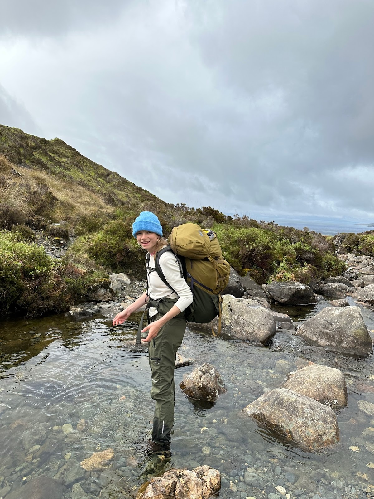
The mouth of Loch Coruisk (left) and crossing the River Scavaig (right).
Day 1: Loch Coruisk to Camasunary Carpark aka the Long Way
Stats: 9.5 miles and ~1800 foot elevation gain
Immediately after we finished the Bad Step, we both agreed we would NOT be taking that route back and instead would take the Long Way we had been previously considering. In retrospect, we probably could have just taken the Bad Step back...but we couldn't resist that warm feeling of knowing that the only challenges ahead of us were related to exhaustion and distance and not falling 20 feet into a rocky wet grave. Unfortunately, we also had a flight to catch from Glasgow at 5pm which meant we had about 12 hours to hike 9 miles and then drive 4-5 back to Glasgow, plus ideally grab some food along the way. No time to waste! We got up at 5:45am, left camp by 6:15am, and began an incredibly wet 9 miles back to Camasunary carpark.
Our initial climb out of Loch Coruisk and up and over the saddle to Loch Sligachan was painful. There were about 6 different parallel trails all the way up from Coruisk, each one wetter than the next. This section is sloooow, I think we paced a 48 minute mile going up. Once got down the saddle we met up with the Sligachan Path, where things flattened out significantly. The sun and clouds were pulling interesting tricks in the valleys as we walked along and this section was calm, pleasant, and resplendent. The trail got wetter and wetter, though, especially after we passed Loch na Creitheach. We attempted to shave off some distance by following an unofficial AllTrails track up to the saddle and ended up trudging uphill through completely saturated bogs and streams for about an hour. As payment for our sufferings, the sun came out and produced a stunning rainbow within the valley of Loch Creitheach. Plus we met a dog.











No comments:
Post a Comment